Annual Spirit Walk is all set to go Saturday Dec 6th from 6 to 8 p.m. Candlelit walk through the conservation area with entertainment stations along the way. Hot chocolate, cookies, pop corn and of course Santa to visit with all the children and share their wishes. Cash only.
Hoping for a bit of snow and hope to see you there.
After a long covid induced hiatus we are pleased to announce the 2022 Spirit Walk is a go. With our partner Catfish Creek Conservation Authority and many volunteers the event will start at 6 p.m. and the last tour through the woods and school house leaves at 7:50 p.m. There will be the usual Christmas music and recently added story by the Grinch and the magician “Hoppy”. Hot chocolate and cookies will be served and the children will get to visit Santa in this quaint forest setting.
A special thanks to this years organizing committee members Michelle Innes, Eileen Harrison, Dave Allen and of course Brian Wilsdon whose vision led to the Spirit Walk for over 20 years.
For more info please contact Brian at 519-633-3064.
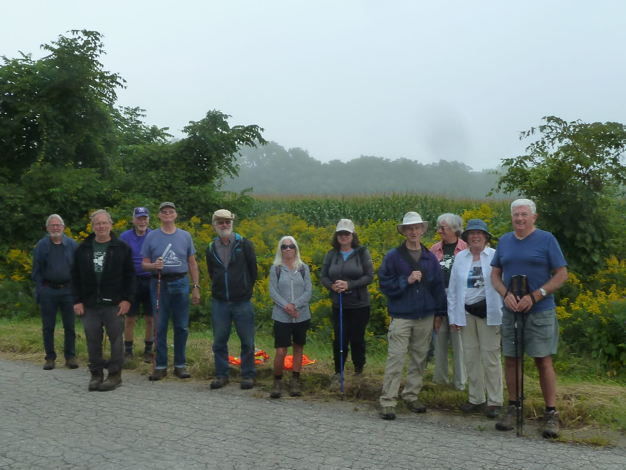
It was a foggy morning when 12 intrepid hikers gathered. First 3.6 km was all road work. At the Red Barn on Hwy 3 we headed into the woods owned by Province of Ontario. The woods wind along the south side of Dodd Creek. When we get to a evergreen forest the roots of the trees make sure you keep looking down.
Root tripping hazardAzure Asters
There are a few steep hills and would be quite slippery if recently rained. We were very fortunate as everything was dry. Along the way we saw Azure Asters and Jewelweed also known as Spotted Touch-me-not, this plant likes damp soil and shade to really bloom. Ruby Throated Hummingbirds really enjoy the Jewelweed.
Dan, this is not
a steep hill.Jewelweed or
Spotted Touch-me-not.
The hike ended at Lyle Rd and on the way back to get car five American Kestrel were sitting on the wire, gathering for the fall migration.
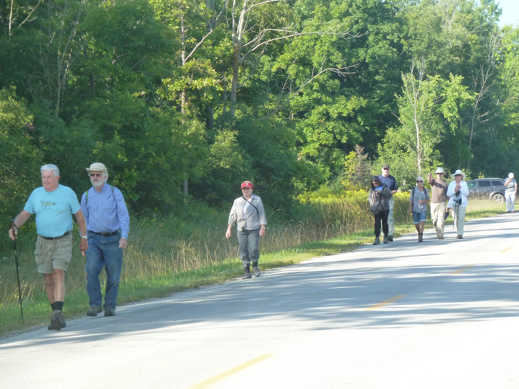
Today we tried our first car pool since the beginning of Covid. We began at the north end of our trail which links up with the Thames Valley Trail which goes to St. Mary’s, known as the stone town. The journey begins with a southward hike through McCaig’ bush. This part of the trail in the spring can be best described as a swamp. In this late summer morning it was quite enjoyable. Our intrepid hike leader Jim was leading and acting as a shield against all the cobwebs. Charlie suggested we tag him #spiderweb. Time will tell if the name sticks.
Upon leaving the bush we head along a farmers field of soybeans. We walk on the east end of the field account the other side of fence row is so overgrown. Exiting the field at the entrance for the tractor on Third Line heading west. Half way along this road we stop for a sugar fix supplied by Roseann.
Turning left onto Mill Rd allows us to safely pass over Hwy 401. Along this road are several seemingly healthy apple trees.
Apple TreeApple Tree
Turning left again onto Fourth Line for 3.6 km. This road really shows off the agricultural roots of Elgin. The hedgerow on this road is largely as it should be.
Agricultural ElginChoke Cherry
There are Choke Cherry trees, Gray and Stiff-leaved Goldenrod and Sweet Pea. There are an abundant supply of Monarch Butterflies and even Monarch Caterpillar visible.
Monarch caterpillarMonarch
This generation of caterpillar will be tasked with making the journey all the way to the mountains in Central Mexico. The Monarch population is down 26% last winter. The problems are illegal logging, drought, pine beetle infestation, lack of milkweed population in all three countries. They inhabited only 2.1 hectares in Mexico. Six hectares is the amount recommended to avoid extinction.
This lovely morning saw 10 of us out for a hike. The rain last night made the hills a bit slippery. The entrance off Hwy 45 will need to be reworked to bring people in just east of the guard rail. Tom and Joan joined us after several week vacation in the East Coast. The canopy overhead and moisture in the ground seems to be conducive to Puff Balls. Not really large but growing.
Bridge needing several boards replaced.
There was one bridge on trail which needs at least 4 planks replaced.
The hike is basically due south and up a hill to farmers roadway. This roadway will take us all the way to Mellor Rd. We then had a rest under the huge evergreens. There were many birds flying around, did manage to recognize Red-headed Woodpecker and Blue Jay. Need binoculars to see the birds that were way up high in the trees.
Pokeweed Pokeweed fruit
On the way back we spotted Pokeweed. This is a plant which is poisonous to humans, dogs and livestock. On the other hand, Gray Catbird, Northern Mockingbird, Northern Cardinal, Brown Thrasher, Mourning Dove and Cedar waxwings will eat the berries when they reach blackish purple. The berries start out green, turning white and then blackish purple.
Today we had eight people out for the hike in warmish weather. Our hike leader is Jim Northey and he has been leading these Wednesday morning hikes for many years, through all four seasons. They always start at Sunset Café and each day is a new adventure.
We start with a zig-zag up the Southdale hill. The zig-zag was done my Rick Atchison, he has done a lot of maintenance on this piece of the trail and we owe him our gratitude. At the top we wander toward the creek then along the top ridge, crossing at the new Tilman Bridge. Tilman Joosten was the architect of this bridge and was able to get Thames Valley Trail Club to pay for the costs. It is a good solid design and should serve the hikers of Elgin County for a very long time. Our thanks to Tilman and the Thames Valley Trail Club.
The trail once again heads on top of the ridge towards Kettle Creek, veering north. The first lookout is mostly clay based and really suffering from erosion.
Dune erosion
The second lookout is sand based. Both give a lovely view of Kettle Creek as it turns south towards Port Stanley. The trail then continues north along the ridge with a view of the subdivision backing right up to the trail. Then you venture down a fairly steep hill with a bridge to cross the ravine half way down.
White Heath AsterJack-in-the-pulpit fruitFungii
At the bottom we circle around the west side of Shaw Valley Pond. It is teeming with life. Today, their were Belted Kingfisher, House and Carolina Wren, Purple Finch, Blue Jay, White-breasted Nuthatch, Tufted Titmouse and Gray Catbird.
The trail continues north along the west side of the pond, down a short hill and veers east for several hundred feet. We then head north again and come out at a field which we cross. Then a bridge and we turn west towards Kettle Creek. Follow it north and cross a group of bridges trying to stay in place battling the constant erosion, again.
Bridges washed out by constant erosion
This spot also sees the creek change direction and you can enjoy the view in both directions. The trail now goes through a damp area that is dry at this time of year. We cross over several bridges and can see how the rain waters are running following the trail. We exit at Sunset Café which is a great place to park the car and walk the trail both ways or take the road to Southdale and back via the trail. All in all, a lovely part of our Elgin Hiking Trail.
My thanks to Jim for taking the time to lead these Wednesday morning hikes.
With the restrictions finally seeming to be lifting on Covid-19, I thought it about time to update the Elgin Trail map. The map is on the map page and a current GPX file can be downloaded to your cell phone.
I am really liking the ATLOGIS Canada Topo Maps Pro it is only around $11 and supports many map formats such as Toporama and in French, OpenStreetMap and my favorite OSM Outdoors. This was not available last year and is a great addition, unfortunately only for Android at moment, do not see it in iPhone app store.
The trail can be downloaded at zoom level eighteen which on my phone is 100 meters at 1 cm which is fine enough to not get lost. It is a lot of tiles so make sure you download with WiFi before going out on the trail.
We had high winds last night and a few more dead ash trees probably fell on the trail. This is an ongoing and endless project. We have several work parties going out this weekend and early next week to clean up parts of the trail. Even though it was technically closed during the pandemic and no one was doing any maintenance. Many people have taken advantage of the trail and enjoyed it.
Unfortunately some people who were not members chose to take it upon themselves and tell a landowner he should not be using a snowmobile on the trail. This angered the landowner and now we have lost a lovely part of the trail.
Just several years ago that part of the trail had a beech tree fall down several days before we were going to have a large group go through celebrating the clubs fourtieth anniversary. A crew went out and cleared the tree in record time. Here is hoping the landowner will realize the value of the club and open his families property back up.
Hope everyone has weathered the isolation and looking forward to enjoying our wonderful trail again. Enjoy the great outdoors and keep safe by social distancing.
Tree all dressed up for Spirit Walk. — photo by John Hutton
This years walk has been cancelled account of impending rain approaching during the event. Much work went into the preparation but mother nature had other ideas. I would like to take this time to express the executives appreciation for all the effort Brian Wilsdon has put into the Spirit Walk. It has been his passion and he has pulled off great Spirit walks over many years.
The trail is now 93% complete and some 22,000 kms long going through 13 provinces and territories. The Great Trail is comprised of 432 individual trail sections of which the Dutton Dunwich trail is one. There is The Great Trail app for IOS and Android designed in partnership with ESRI Canada. Everyone is invited to celebrate the near completion of the Trans Canada Trail with a hike on August 26th. It would be awesome if we had a real good representation from the club. Long time member Marg Hulls will be leading the hike with a barbecue to follow. Information in poster above and a nice article in the St. Thomas Times Journal last Friday. The first 75 registrants will receive a commemorative embroidered badge. Hope to see you there.
Wendy, Phyllis and Tom at Santa’s way station in Union.
We had a total of 15 people out for the fall end-to-end. Four people completed the whole trail with new member Joan being one of them. Congratulations Joan. We had three regular hikers miss the first hike which was cut short due to rain. The rain make up hike was also poorly attended due to slippery conditions. The trail was in pretty good condition and everyone enjoyed themselves. We saw a buck on second hike. Nine new people jointed us on at least one of the hikes and we hope to see them out on our winter hikes. Thank you to all who came out and made the hikes so enjoyable.